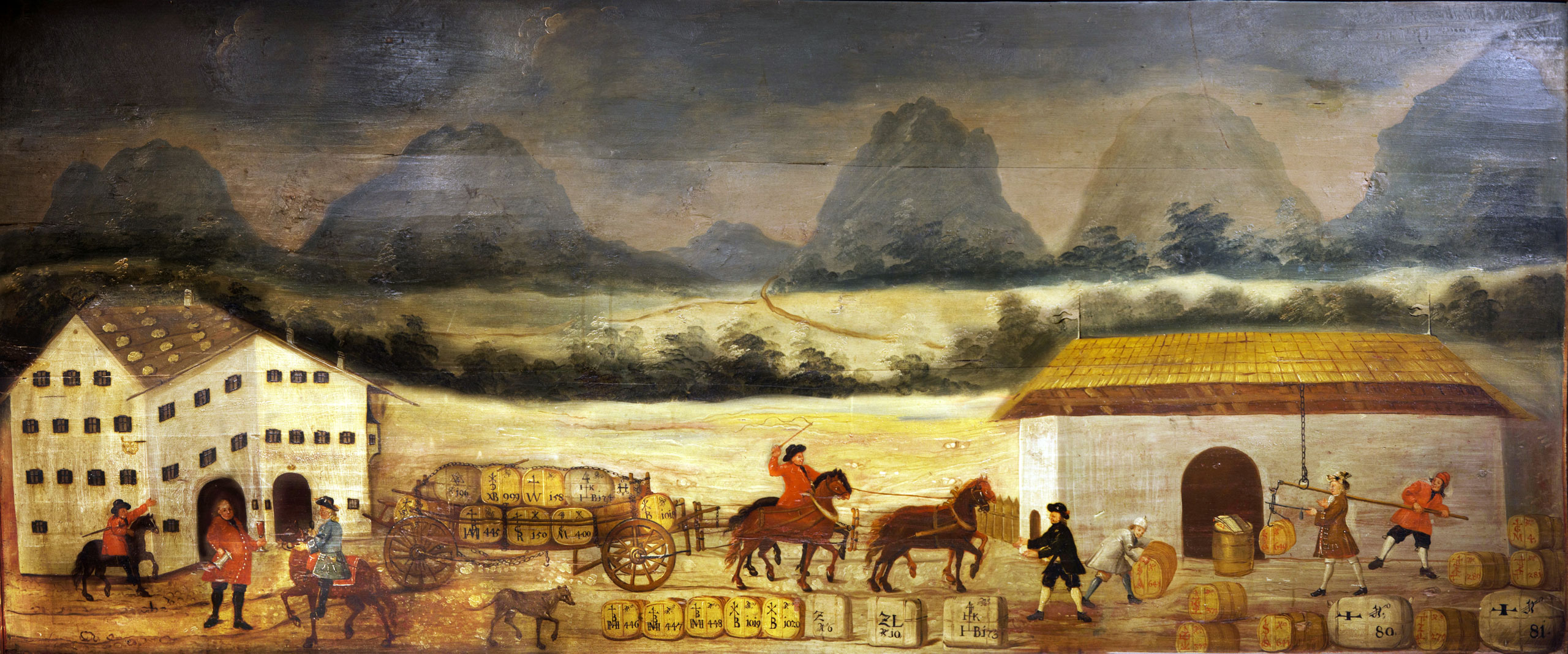
Eighteenth-century stage transportation and transshipment station, Museum “Grünes Haus”, Reutte (by kind permission of the museum)
ALPINNKONNECT provides, for the first time, a systematic analysis of interrelated actors and activities; organisation, administration and financing; built materiality, animals and impacts of non-human nature.
ALPINNKONNECT focuses on the operation of eighteenth-century trans-European commercial traffic along three main transit routes through the Alps that connected the North and the South: the Brenner route in Tyrol and the Swiss pass routes crossing the Splügen and the St Gotthard. In the early modern period, huge quantities of goods were transported on these routes.
Transit trade and traffic are seen as a manifestation and engine of prosperity, as they constituted an important source of income for villages and towns, as well as for provinces, territories and the state. Transportation was an expanding economy in early modern Europe. It developed diverse and competing forms of organisation.
ALPINNKONNECT puts the spotlight on those who organised and carried out the transportation and those who provided, maintained and operated the necessary prerequisites. The project therefore concentrates on local sites along the transit routes. In order to explore the requirements for keeping transcontinental European commercial traffic running, it is necessary to include animal and material facilities in the investigation: roads, bridges and inns, as well as stables for pack and wagon horses, warehouses for the goods that were transhipped at the transit stations (Ballhäuser, Susten), freight forwarder offices and customs stations.
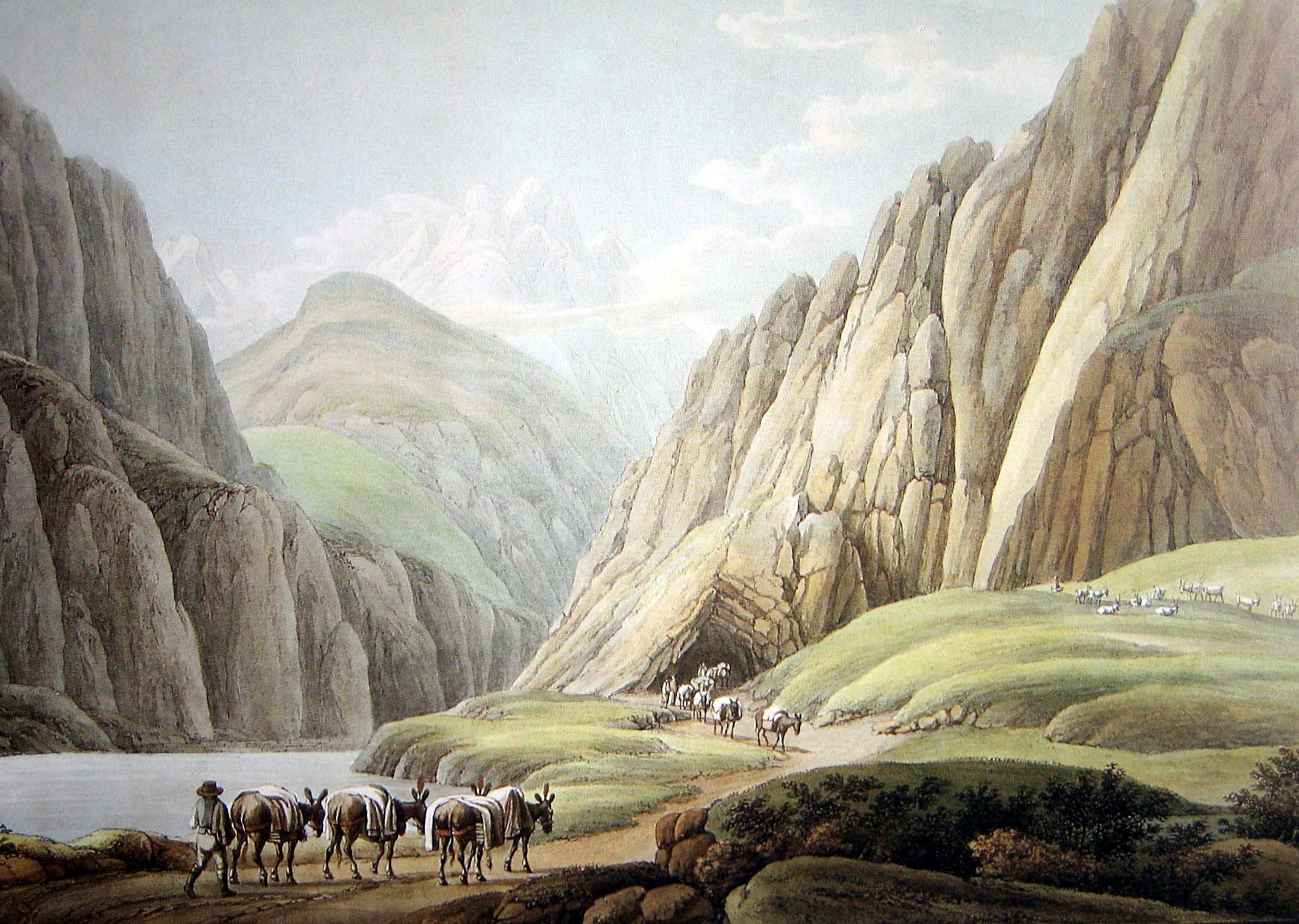
Mule packers at the Urnerloch, 1790, coloured engraving by Wilhelm Rothe (1783–1845) after Johann Gottfried Jentsch (1759–1826), public domain
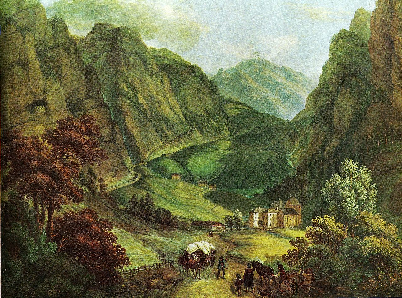
Lueg customs office at the Brenner Pass, early nineteenth century, Ferdinand Runk, public domain
In particular, the project considers ALPine INNKeepers as cONNECTing agents in the commercial world of transit traffic and defines inns as multipurpose hubs. Innkeepers appear as local key figures and pluriactive players. They were connected with other transport operators: carters, muleteers, raftsmen and freight forwarders, as well as local cooperatives: Rodgenossenschaften and Säumergenossenschaften. Women were constitutive not only for the social and economic status of innkeepers but also for the day-to-day running of the business. This raises the question of whether specific marriage networks existed along the transit routes.
At the same time, ALPINNKONNECT asks about the specific conditions in the Alpine landscape, on the roads, mule tracks and rivers, which varied according to the season and the impact of weather events and disasters.
The main goal of ALPINNKONNECT is to arrive at a comprehensive, empirically based understanding of the preconditions and processes, the problems and lasting effects of transit traffic and its changes, by analysing the interplay of the agents involved and their organisational practices, as well as the material foundations of the transportation of goods across the Alps on different routes:
first, by focusing on agents at the local level,
second, by integrating marriage, kinship and gender,
third, by including material facilities and the natural environment.
ALPINNKONNECT therefore aims to
- redefine logistics and infrastructure through a socio-historical and historical-anthropological lens
- reconceptualise a ‘materialised’ social history
ALPINNKONNECT derives its exceptional potential from the systematic interweaving of perspectives on the social, the material and the natural in a dynamic and at the same time symmetrical way – conceived as socio-material-natural interconnectedness.
In a broader sense, land traffic between northern Italy and central and northern Europe remained essential in the eighteenth century, even though a large part of European commercial traffic was being shifted to the sea. Thus, the Alps were not a barrier, but an important intermediary and connecting link – not despite, but complementary to, the economic rise of northwestern Europe.
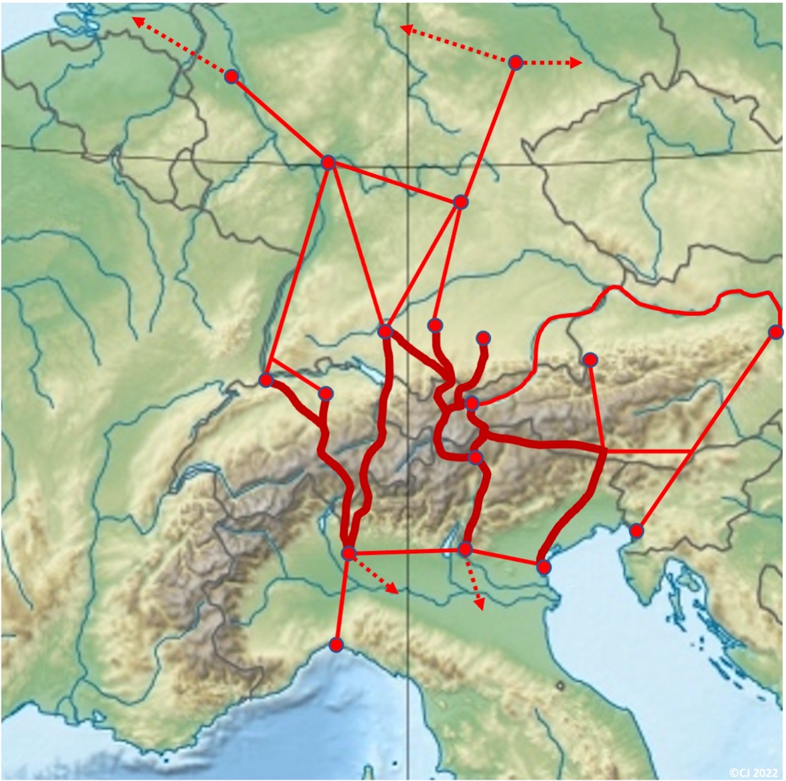
Central and Eastern transalpine trade routes, map created by Christof Jeggle based on the “Europe relief laea location map”, made with Natural Earth (Free vector and raster map data @ naturalearthdata.com)
News

News List: Workshops, Excursions and Interviews
List of the project’s workshops, excursions and interviews, providing a clear overview of all past…

